24 Aug Weather in Cayman & Tropical Report, 3 Dist, 1 TS,
Thu 24 Aug 2023
TROPICAL REPORT
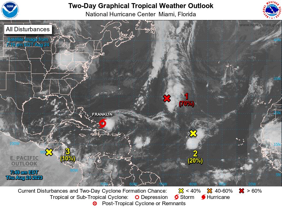
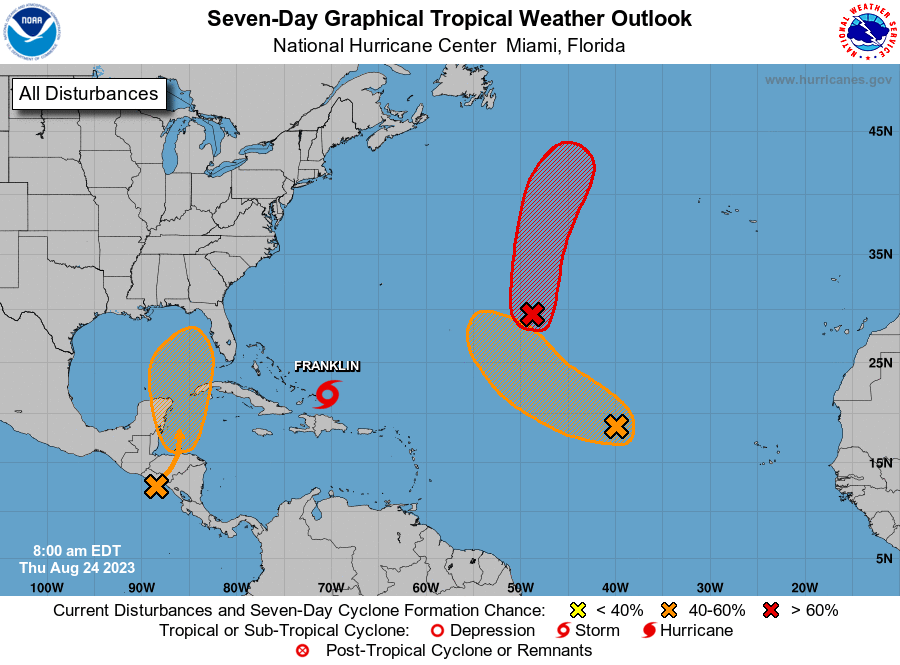
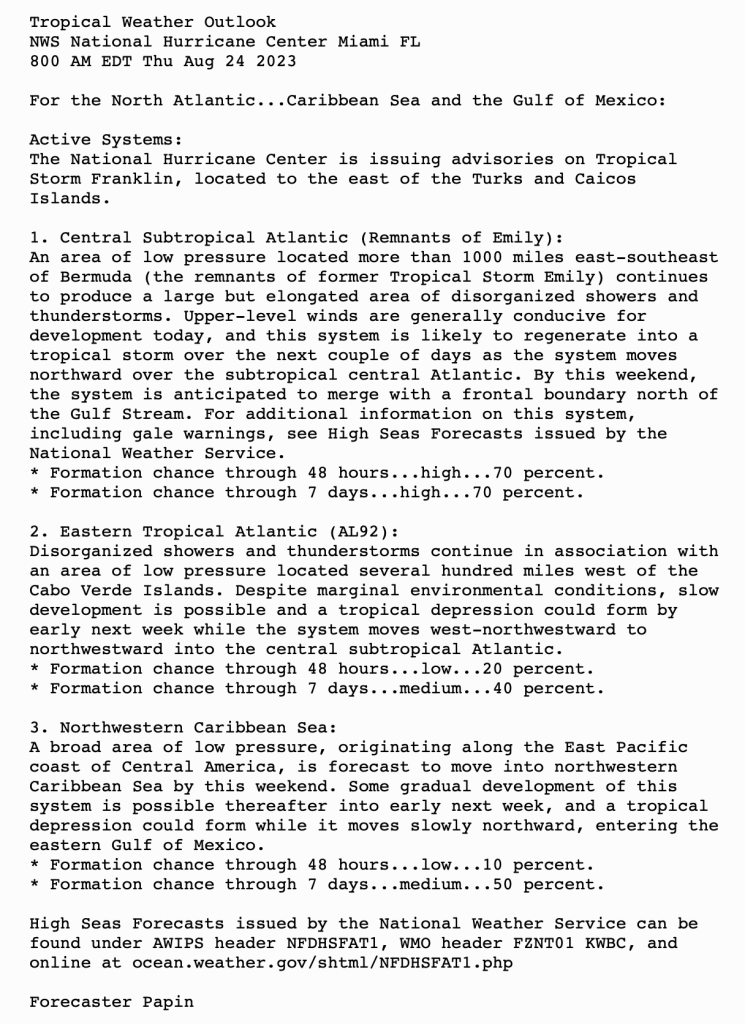
ATLANTIC Tropical Weather Outlook
| Atlantic – Caribbean Sea – Gulf of Mexico | |
|---|---|
| Tropical Weather Outlook (en Español*) 800 AM EDT Thu 24 Aug 2023 | |
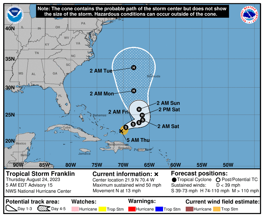
Tropical Storm Franklin
FRANKLIN PULLING AWAY FROM THE TURKS AND CAICOS… …FORECAST TO STRENGTHEN

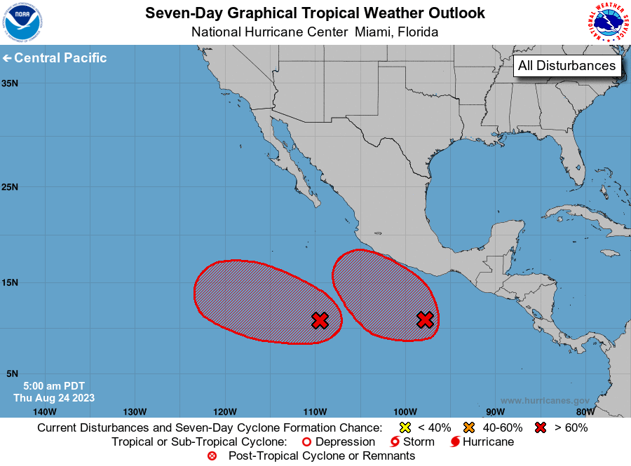
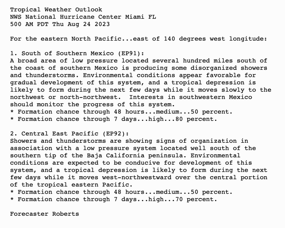
Eastern North Pacific (East of 140°W)
Tropical Weather Outlook
500 AM EDT Thu 24 Aug 2023
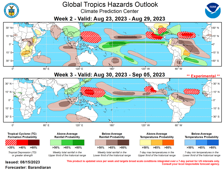
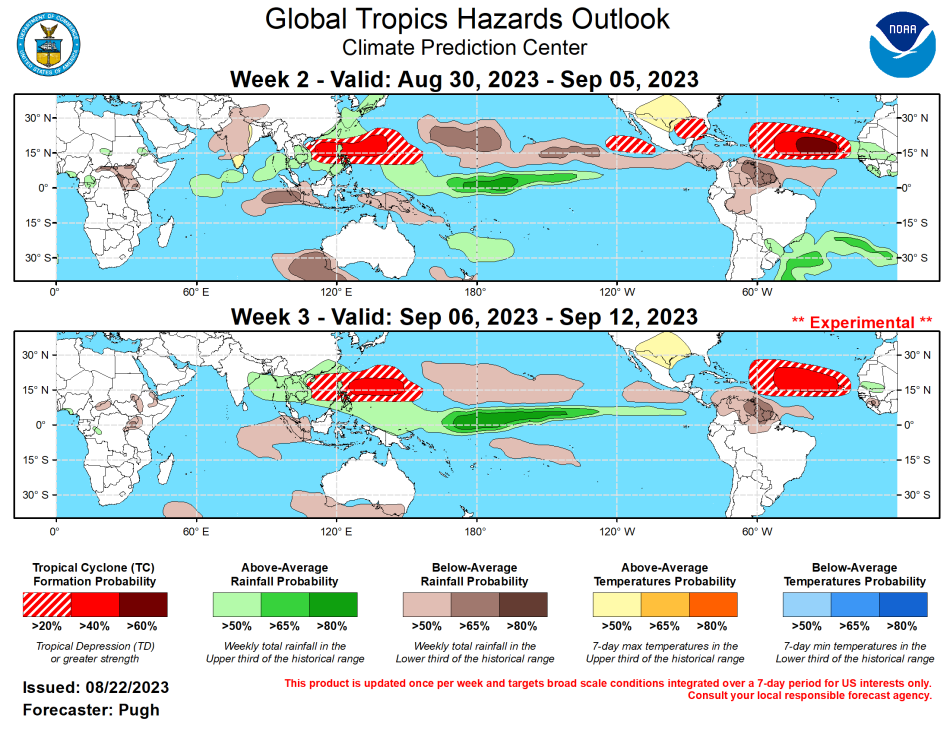
NOAA Climate Prediction Center
Weather in Cayman
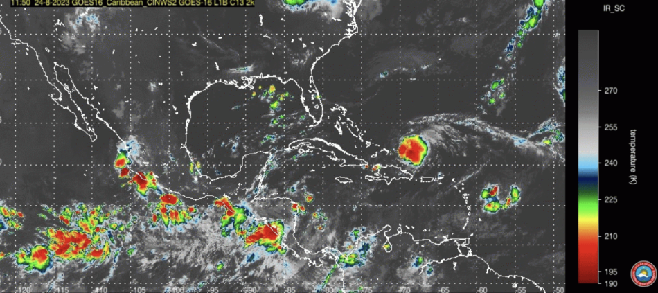
SYNOPSIS
Isolated showers across the northwest Caribbean are likely to drift over the Cayman area today with showers expected mainly in the afternoon. Light winds and seas are also expected for the next 24 hours as the pressure gradient weakens across the Northwest Caribbean.
DAY: Isolated thunderstorms this morning. Skies will become partly cloudy this afternoon. Winds ESE at 5 to 10 mph. NIGHT: Some clouds. Winds Light & variable.
Sea: Slight with a wave height of 1 to 3 feet.
UV: 12 EXTREME UP from yesterday. Daily Max at 11am.
Temperatures: Yesterday – Low 78.3°F, High 90.2°F Today (Expected) – Low 78°F High 90°F
Barometer: 1008 mb
Humidity: 84%
Rain: Last month: 0.88 in
Rain this month: 8.28 in
Last 24 hrs (since yesterday’s readings) 0.06 in. 0 days since rain, 13 rain days in Aug
2022 Season Total: 57.49 in
2023 Season Total: 20.16 in
Chance of rain: 30%
Notes:
Latest rainfall readings are from HALF WAY POND
Average rainfall in Aug: 6.7 in.
Average temperature in Aug: 77°F to 90°F
Sea Temperature in Aug: 84°F
MOON: 51% Illumination

Waxing Gibbous
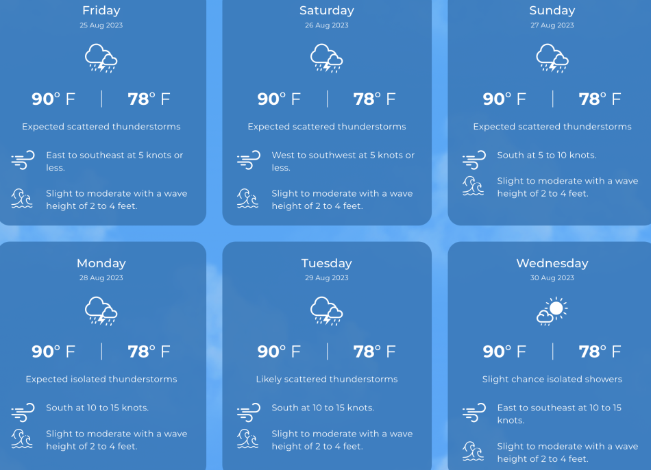
LOCAL 6 DAY FORECAST
Grand Cayman Sun & Tides Tables Aug 2023
From Tides4fishing
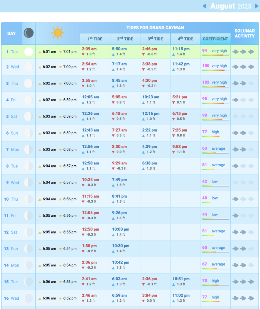
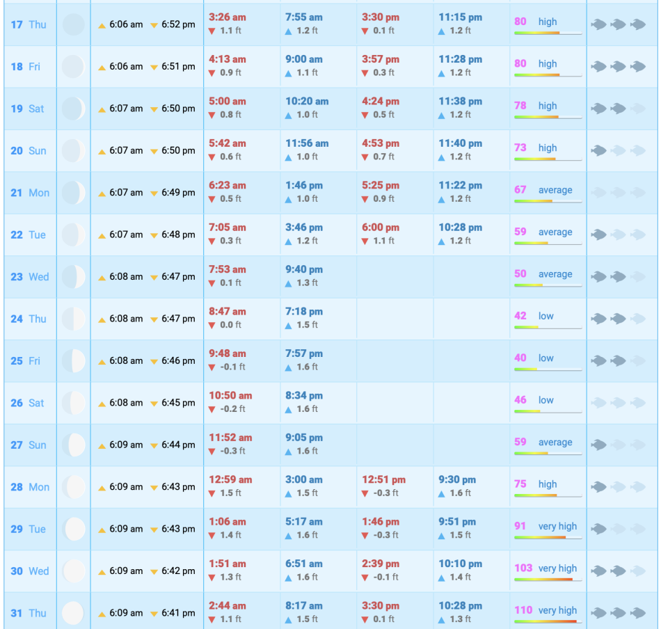
IMPORTANT NOTICEThe times reflected in the tidal table for Grand Cayman are predictions valid as references for sports fishing in areas near the coast of Grand Cayman. THEY ARE NOT SUITABLE FOR NAVIGATION. Remember that to practice any activity at sea like diving, windsurfing and fishing from a boat or underwater fishing should always be consulted with the official tide tables of the port of Grand Cayman.
UV WARNINGS
Moderate: 3-5 Take precautions by covering up, and wearing a hat, sunglasses and sunscreen, especially if you will be outside for 30 minutes or more. Look for shade near midday when the sun is strongest.
High: 6-7 Protection required – UV damages the skin and can cause sunburn. Reduce time in the sun between 11 a.m. and 3 p.m. and take full precaution by seeking shade, covering up exposed skin, wearing a hat and sunglasses, and applying sunscreen.
Very High: 8-10 Extra precaution required – unprotected skin will be damaged and can burn quickly. Avoid the sun between 11 a.m. and 3 p.m. and seek shade, cover up, and wear a hat, sunglasses and sunscreen.
Extreme: 11+ Take full precaution. Unprotected skin will be damaged and can burn in minutes. Avoid the sun between 11 a.m. and 3 p.m., cover up, and wear a hat, sunglasses and sunscreen. Don’t forget that white sand and other bright surfaces reflect UV and increase UV exposure.
See: http://www.weather.gov.ky/portal/page?_
FOR RADAR IMAGE GO TO: https://www.weather.gov.ky/radar
Also see Weather In Cayman: http://www.weatherincayman.com
UV Report From THE WEATHER NETWORK
Moon info and graphic: https://www.timeanddate.com/astronomy/cayman-islands/george-town
Tropical storm data and graphics from National Hurricane Center at: https://www.nhc.noaa.gov/
Weathernerds: http:// https://www.weathernerds.org/
Mikes Weather Page: https://spaghettimodels.co


