Spy satellites reveal extent of Himalayan glacier loss
By Rebecca Morelle From BBC

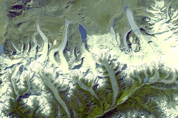
Images from Cold War spy satellites have revealed the dramatic extent of ice loss in the Himalayan glaciers.
Scientists compared photographs taken by a US reconnaissance programme with recent spacecraft observations and found that melting in the region has doubled over the last 40 years.
The study shows that since 2000, glaciers heights have been shrinking by an average of 0.5m per year.
The researchers say that climate change is the main cause.
“From this study, we really see the clearest picture yet of how Himalayan glaciers have changed,” Joshua Maurer, from Columbia University’s Lamont-Doherty Earth Observatory in New York, told BBC News.
The research is published in the journal Science Advances.


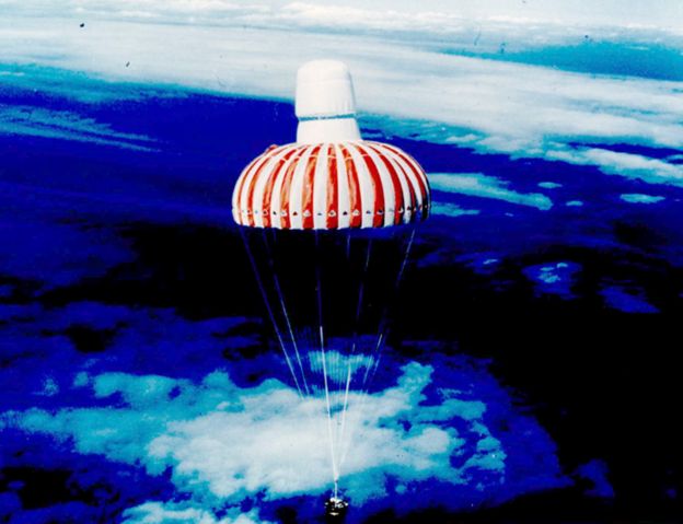
During the 1970s and 1980s, a US spy programme – codenamed Hexagon – launched 20 satellites into orbit to secretly photograph the Earth.
The covert images were taken on rolls of film that were then dropped by the satellites into the atmosphere to be collected mid-air by passing military planes.
The material was declassified in 2011, and has been digitised by the US Geological Survey for scientists to use.
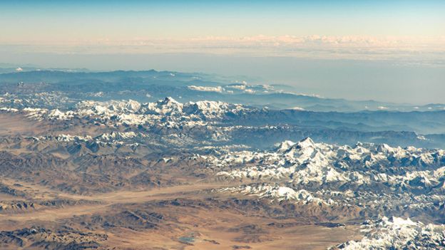
Among the spy photos are the Himalayas – an area for which historical data is scarce.
By comparing these pictures with more recent satellite data from Nasa and the Japanese space agency (Jaxa), the researchers have been able to see how the region has changed.
The Columbia University team looked at 650 glaciers in the Himalayas spanning 2,000km.
The group found that between 1975 and 2000, an average of 4bn tonnes of ice was being lost each year.
But between 2000 and 2016, the glaciers melted approximately twice as fast – losing about 8bn tonnes of ice each year on average.


Mr Maurer said: “For a sense of scale, 8bn tonnes of ice is enough to fill 3.2 million Olympic-sized swimming pools per year.”
And the ice loss was not uniform, he added.
“Glaciers lose most of their ice in the lower elevation portions of the glacier, and it’s there where most of the thinning is concentrated.
“Some of those zones have been thinning by as much as 5m per year.”
Among the scientific community, there has been some debate over the cause. Changes in rainfall in the region and soot deposited from industrial pollutants are thought to have hastened the melt.
However the Columbia team said that while these factors were contributing, rising temperatures in the Himalayas were the main cause.
“The fact we see such a similar spatial pattern of ice loss across so many glaciers across such a large and climatically complex region suggests there needs to be some kind of overall forcing affecting all of the glaciers similarly.”


Scientists say continued losses will have a huge impact.
In the short-term, the huge increase in meltwater could cause flooding.
In the longer term, millions of people in the region who depend on glacier meltwater during drought years could experience very real difficulties.
Commenting on the research, Dr Hamish Pritchard from the British Antarctic Survey, said: “What’s new here is being able to see how the melting of glaciers across the whole Himalayan range has increased due to climate change.
“Over one generation, the melt has doubled and these glaciers are now shrinking fast.
“Why does this matter? Because when the ice runs out, some of Asia’s most important rivers will lose a water supply that keeps them flowing through drought summers, just when water is at its most valuable.
“Without mountain glaciers, droughts will be worse for millions of water-stressed people living downstream.”


For more on this story go to; https://www.bbc.com/news/science-environment-48696023


