Tropical Depression Seven forms in Atlantic
From NHC
DEPRESSION MOVING WESTWARD WITH NO CHANGE IN STRENGTH… …FORECAST TO BECOME A TROPICAL STORM TONIGHT OR THURSDAY

Tropical Depression Seven Discussion Number   2
NWS National Hurricane Center Miami FL       AL072022
500 PM AST Wed Sep 14 2022

Deep convection has continued to burst near and to the east of the
center of the depression this afternoon, but overall there has been
no significant change in the system's organization.  An ASCAT-C
scatterometer overpass that arrived just after the release of the
previous advisory revealed some believable 30-kt vectors within the
eastern portion of the primary convective mass.  Although the system
continues to be affected by moderate westerly shear, it is likely
not far from tropical storm strength.  The initial intensity is held
at 30 kt, and is based on the latest Dvorak estimate from TAFB.

Arc clouds have been propagating away from the convection today,
indicating that the system is located within a relatively dry mid-
level environment.  Since both the shear and dry air are likely to
persist during the next few days, only modest strengthening is
indicated in the official forecast.  One change in the latest global
model guidance is that most now maintain the system as a tropical
cyclone into the eastern Caribbean, much like was shown in the
previous NHC advisory.  The latest NHC intensity forecast is
unchanged from before, and calls for the depression to become a
tropical storm tonight or Thursday. Little change in intensity is
shown after that time due to environmental uncertainties and the
potential interaction with land, and the official forecast lies
near the statistical models (SHIPS and LGEM).

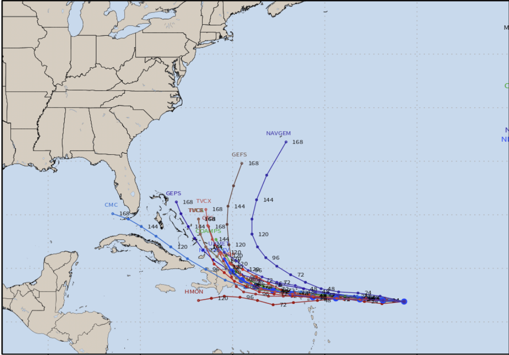
The longer-term motion of the depression is generally west at about
11 kt.  There is no change to the early portion of the track
forecast reasoning.  The depression is expected to be steered
slightly north of due west along the southern side of a low- to
mid-level ridge over the central and western Atlantic during the
next few days.  There is very little cross-track spread in the
guidance during that time, but there is considerable along-track
differences with the ECWMF much faster than the remainder of the
guidance.  The NHC official forecast is again closer to the HFIP
corrected consensus and GFS ensemble mean, but it is slightly slower
than the previous track through day 3.  At days 4 and 5, there has
been a change in the guidance since most of the  models depict a
stronger and more vertically deep cyclone by the end of period. This
has resulted in a more poleward track toward the end of the forecast
period, and the NHC track has been adjusted in the direction.  There
is still considerable uncertainty in the longer range portion of the
forecast as there is a bifurcation in the ensemble guidance that is
related to the system's intensity at the longer range. Ensemble
members that keep the system weak generally show a faster and
farther south track, than the official forecast.

Key Messages:

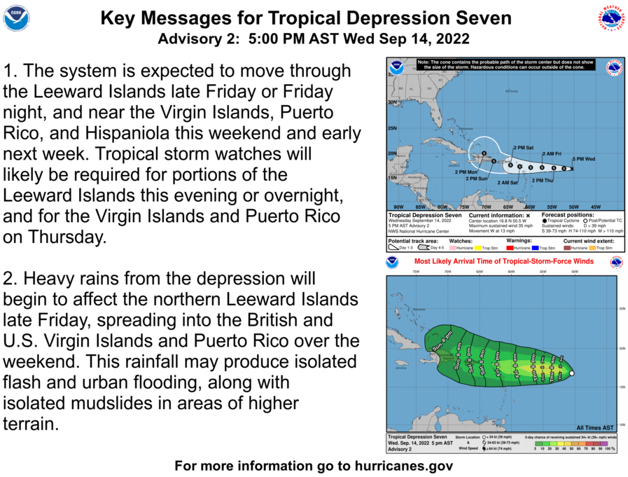
1.  The system is expected to move through the Leeward Islands
late Friday or Friday night, and near the Virgin Islands, Puerto
Rico, and Hispaniola this weekend and early next week.  Tropical
storm watches will likely be required for portions of the Leeward
Islands this evening or overnight, and for the Virgin Islands and
Puerto Rico on Thursday.

2. Heavy rains from the depression will begin to affect the
northern Leeward Islands late Friday, spreading into the British
and U.S. Virgin Islands and Puerto Rico over the weekend. This
rainfall may produce isolated flash and urban flooding, along with
isolated mudslides in areas of higher terrain.


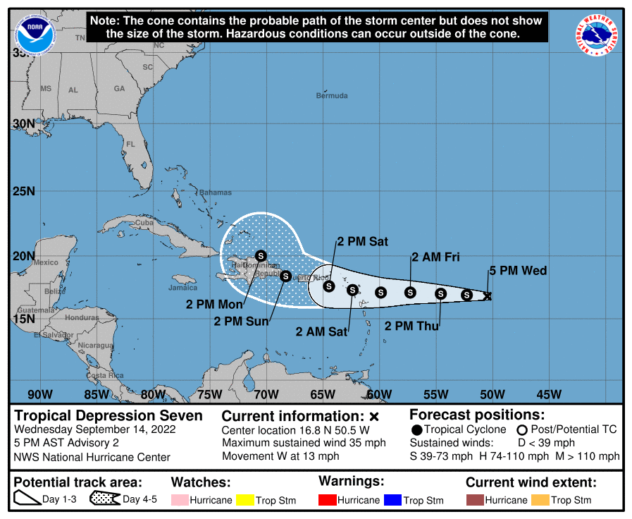
FORECAST POSITIONS AND MAX WINDS

INIT  14/2100Z 16.8N  50.5W   30 KT  35 MPH
 12H  15/0600Z 16.9N  52.3W   35 KT  40 MPH
 24H  15/1800Z 17.0N  54.6W   40 KT  45 MPH
 36H  16/0600Z 17.1N  57.3W   40 KT  45 MPH
 48H  16/1800Z 17.1N  59.9W   40 KT  45 MPH
 60H  17/0600Z 17.3N  62.4W   40 KT  45 MPH
 72H  17/1800Z 17.6N  64.5W   40 KT  45 MPH
 96H  18/1800Z 18.4N  68.3W   40 KT  45 MPH
120H  19/1800Z 20.0N  70.5W   40 KT  45 MPH

$$
Forecaster Brown
