Hurricane threat brewing in the Caribbean; Florida on alert for potential impacts next week
From AccuWeather
> Increasing risk of a major hurricane developing in the Caribbean Sea
> Exceptionally warm water temperatures and low wind shear will support the potential of rapid intensification this weekend
> The strength and location of an area of high pressure over the southeastern United States will determine if the storm tracks west toward Central America or north toward Florida next week
AccuWeather Global Weather Center – Nov. 12, 2024 – People on the Caribbean islands and across Florida are being urged to closely monitor forecast updates as AccuWeather hurricane experts monitor the increasing risk of a major hurricane developing in the Caribbean Sea.
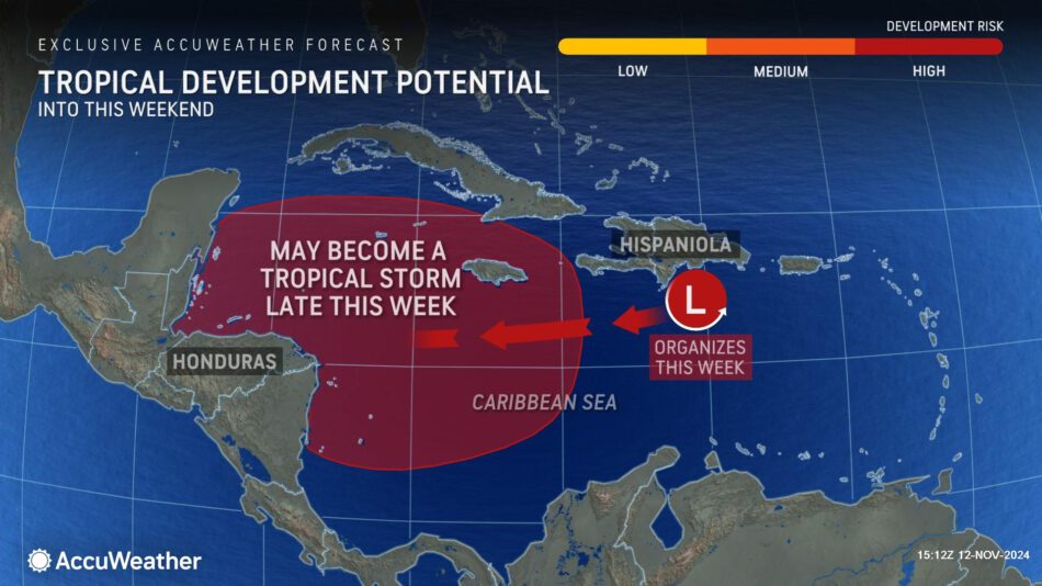
“We’ll likely be dealing with a hurricane as we head into this weekend. There is increasing confidence that a tropical storm will develop in the central to western Caribbean later this week,” explained AccuWeather Lead Hurricane Expert Alex DaSilva. “We could be dealing with a storm that rapidly intensifies into a major hurricane in these very conducive conditions. The atmosphere is primed for development.”
AccuWeather was the first known source to issue a high risk for tropical development in the western Caribbean Monday morning. The next name on the list of tropical storms for the 2024 Atlantic hurricane season is Sara.
Prime conditions for a mid-November hurricane
The Caribbean Sea has been a hotspot for tropical development in recent weeks, and AccuWeather hurricane experts say atmospheric conditions will be conducive through next week.
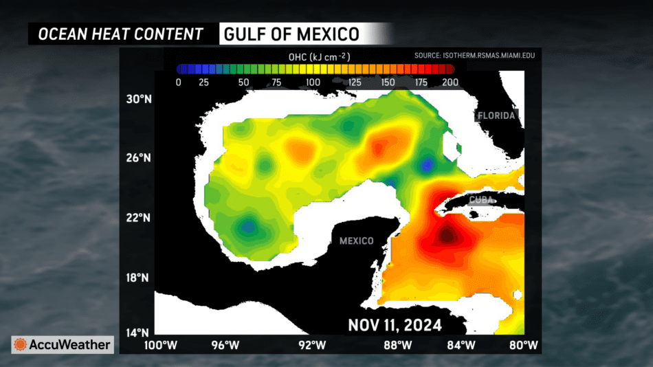
“The Ocean Heat Content, which is how deep the warm waters extend below the surface of the ocean, is at record levels for the time of the year in the Caribbean. The depth of the 80-degree temperature line extends 300-400 feet down below the surface of the ocean in the western Caribbean. This can act like rocket fuel for developing tropical storms or hurricanes,” said DaSilva. “The wind shear in the western Caribbean is also expected to be low over the next 10 days. The low wind shear, combined with the exceptionally high Ocean Heat Content, can lead to rapid development over the coming weekend.”
AccuWeather Chief On-Air Meteorologist Bernie Rayno says another weather factor could contribute to this developing storm.
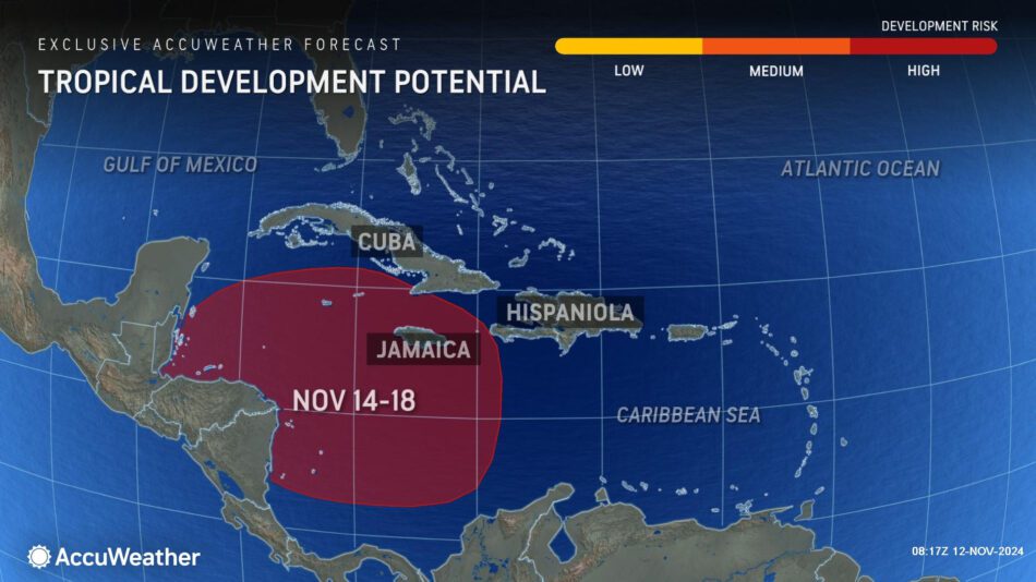
“A frontal boundary that could stall over the Caribbean islands would provide upward motion to boost the development of showers and thunderstorms,” Rayno explained. “With extremely warm waters and very low wind shear, there’s little in the way that could prevent this storm from quickly strengthening. This will likely be our 12th hurricane of the season.”
Storm track scenarios
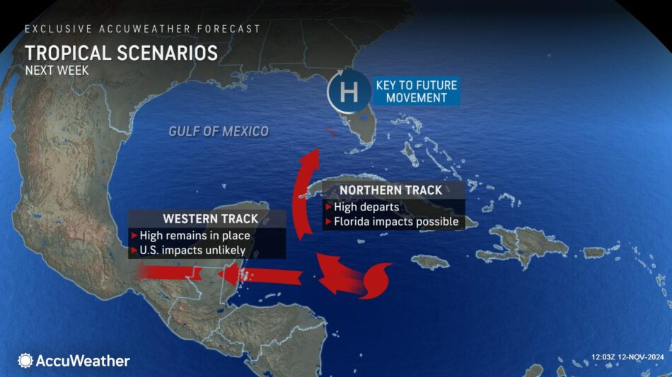
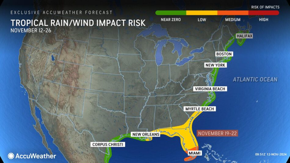
AccuWeather hurricane experts say there are two main storm track scenarios that could determine where this storm develops and eventually makes landfall.
“If an area of high pressure to the north is stronger, the storm will likely be pushed west into Central America. If the area of high pressure is weaker, that could allow the storm to turn to the north toward Florida,” DaSilva said. “Everyone along the Gulf coast of Florida should keep a very close eye on forecast updates.”
AccuWeather Chief Meteorologist Jon Porter says families and businesses across Florida and the southeast U.S. should remain prepared and vigilant through the final weeks of the Atlantic hurricane season.
“These warm waters will act like high-octane rocket fuel for this brewing storm. We’ve been warning people for months that the final stretch of this hurricane season would be very active. After that long lull during the historical peak of the hurricane season, we’re now dealing with the threat of a major hurricane in the Caribbean in the middle of November,” Porter said. “In late October we forecasted one to three named tropical storms for the month of November and the potential for storms extending beyond the official end of hurricane season into December. The historical average for named storms in November is one every two years.”
Tropical downpours from the Gulf Coast through the Tennessee Valley
A combination of moisture from the Gulf leftover from Rafael and an area of low pressure approaching from the west, will lead to slow-moving showers and thunderstorms from the northern Gulf Coast north through the Tennessee Valley Wednesday and Thursday.
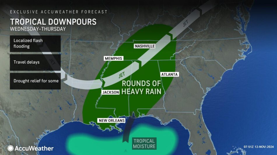
AccuWeather expert meteorologists say several inches of rain are possible, which could trigger localized flooding, but that the rainfall will also provide relief in areas experiencing abnormal dryness or drought conditions.
Additional AccuWeather Resources:
Tropical Storm Sara likely to form in Caribbean, threaten Florida
2024 hurricane season names: Is your name on the list?
AccuWeather Hurricane Tracker
For the latest news and updates visit AccuWeather.com
385 Science Park Road | State College, PA 16803
pr@AccuWeather.com


