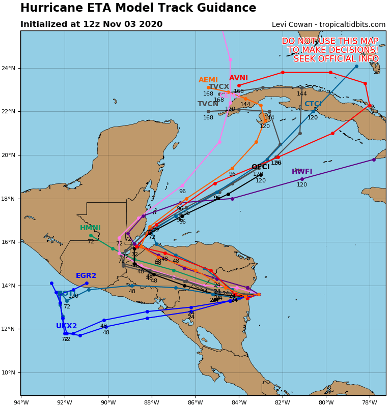
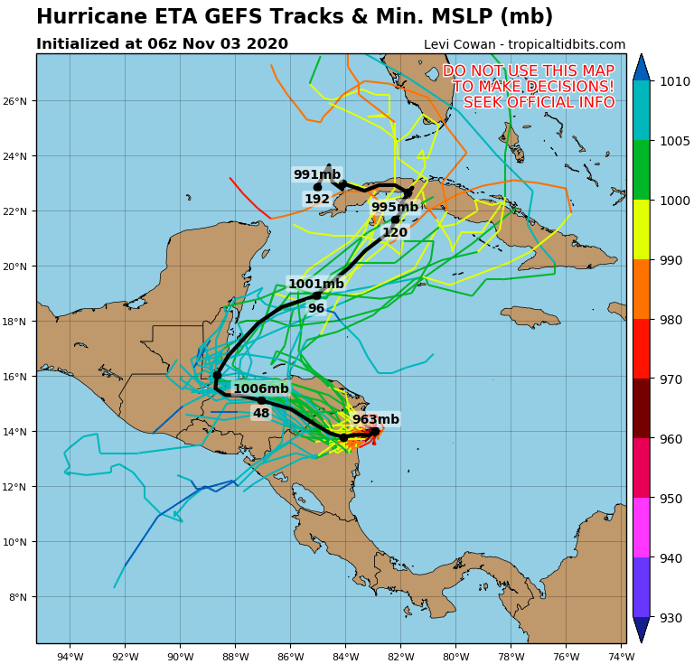
NHC show Hurricane ETA doing U-Turn and Cayman in the cone
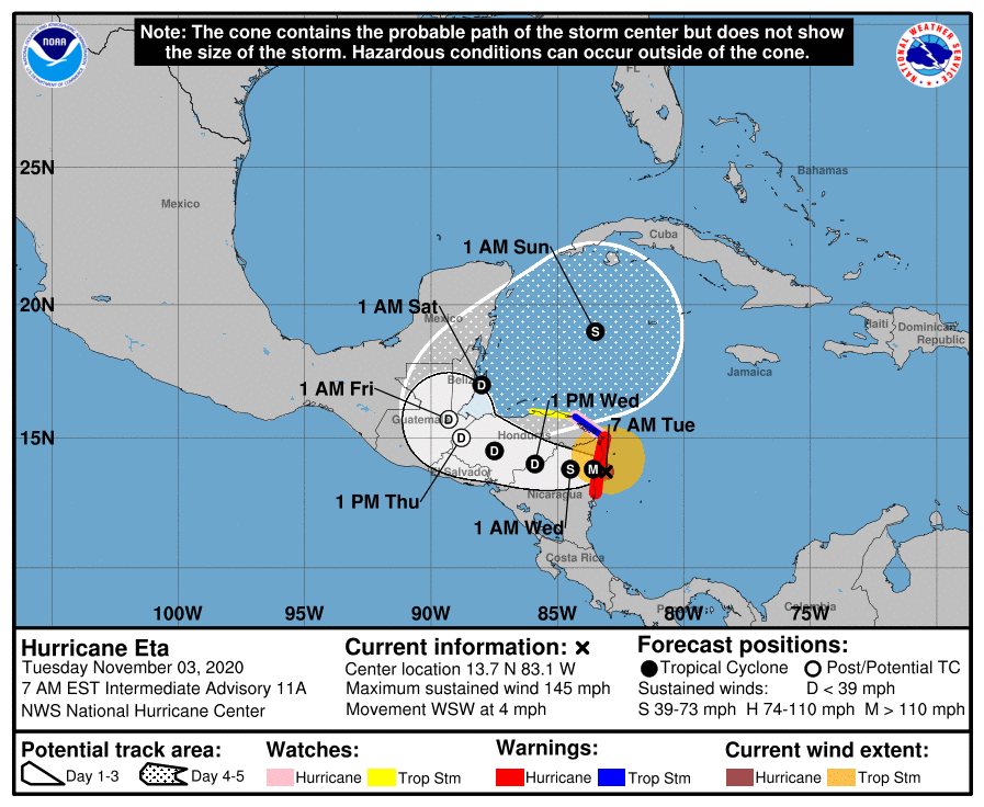
Hurricane Eta Discussion Number 11
NWS National Hurricane Center Miami FL AL292020
400 AM EST Tue Nov 03 2020
Eta remains an extremely well-organized hurricane with a distinct
eye embedded within cloud tops colder than -80C. Based on
continuity from the earlier Hurricane Hunter observations and
Dvorak classifications from TAFB and SAB, the current intensity
estimate remains 130 kt. Images from the San Andres radar show
at least one concentric eyewall, and this structure has likely
stopped the rapid deepening process. Nonetheless, Eta is an
extremely severe hurricane, capable of causing very high storm
surges and catastrophic damage. After the center moves inland
later today, rapid weakening is likely while the circulation
interacts with land. The official forecast is similar to the
Decay-SHIPS guidance, and shows the cyclone weakening to a
depression by tomorrow. It is not certain that the surface
circulation will survive after moving over Central America for the
next 3 days or so. The official forecast shows the system, perhaps
at first the upper-level remnant of Eta, emerging over the
northwestern Caribbean Sea in the latter part of the forecast
period. It should be noted that both the intensity and track at 4-5
days are highly uncertain at this time.
The hurricane has slowed down and is now moving a little south of
west or about 250/4 kt. This motion will take the center across
the coast in the Hurricane Warning area very soon. A weak ridge to
the north of Eta should cause the cyclone to move west to
west-northwest, over Central America, during the next few days. By
96-120 hours, a trough developing over the Gulf of Mexico should
cause the system to turn northward and northeastward but, as noted
earlier, this future track is quite uncertain.
Since Eta is likely to be a very slow-moving system after it makes
landfall in Central America, torrential rains and inland flooding
will be an extremely serious threat over the next few days.
Key Messages:
- Catastrophic wind damage is expected where Eta’s eyewall moves
onshore along the northeastern coast of Nicaragua this morning.
Tropical-storm-force or greater winds are already occuring within
the Hurricane Warning area in Nicaragua. A Tropical Storm Warning
is also in effect for the northeastern coast of Honduras. - A catastrophic and life-threatening storm surge, along with
destructive waves, are expected along portions of the northeastern
coast of Nicaragua near and to the north of where the center makes
landfall. Water levels could reach as high as 14 to 21 feet above
normal tide levels in some parts of the hurricane warning area.
Preparations to protect life and property should now be complete. - Through Friday evening, heavy rainfall from Eta will lead to
catastrophic, life-threatening flash flooding and river flooding
across portions of Central America, along with landslides in areas
of higher terrain. Flash and river flooding is also possible across
Jamaica, southeast Mexico, El Salvador, southern Haiti, and the
Cayman Islands.
FORECAST POSITIONS AND MAX WINDS
INIT 03/0900Z 13.8N 83.1W 130 KT 150 MPH
12H 03/1800Z 13.8N 83.6W 110 KT 125 MPH…INLAND
24H 04/0600Z 13.8N 84.5W 50 KT 60 MPH…INLAND
36H 04/1800Z 14.0N 85.9W 30 KT 35 MPH…INLAND
48H 05/0600Z 14.5N 87.5W 25 KT 30 MPH…INLAND
60H 05/1800Z 15.0N 88.8W 25 KT 30 MPH…POST-TROP/REMNT LOW
72H 06/0600Z 15.7N 89.3W 25 KT 30 MPH…POST-TROP/REMNT LOW
96H 07/0600Z 17.0N 88.0W 25 KT 30 MPH…OVER WATER
120H 08/0600Z 19.0N 83.5W 35 KT 40 MPH
