What it’s really like to fly into a hurricane, and why it’s a critical part of your forecast
 By Hilary Brueck Sfrom Business Insider
Hurricane hunters have been flying directly into storms for 75 years.
There’s no better way to get a clear, accurate picture of how strong and windy a hurricane is.
Scientists in the airplane measure the wind speeds and pressure inside hurricanes. It’s information we can’t get from satellites.
They also try not to hurl.
Hurricane scientist Jon Zawislak told us what a bumpy ride inside a hurricane is really like.
Before he heads to work, Jon Zawislak sometimes pops a ginger pill in his mouth to settle his stomach. He also prefers to stick to bland foods like pretzels and crackers before he gets to the office, because he wouldn’t want to hurl all over his desk.
Zawislak is a Hurricane Hunter.
He spends 8-hour long days soaring 10,000 feet in the air, collecting data on the wind, temperature, pressure, humidity, and rain falling inside big storms, where hurricane-force winds top 75 mph.
While others on the ground are figuring out the best ways to avoid the eyes of these dangerous storms, he flies right into them.
“Aircraft are still the single best platform that we have to measure the state of a storm,” Zawislak told Business Insider. “When it comes to the windfield, or the central pressure of the storm, that kind of data can only really come from an aircraft, and the instruments on the airplane.”
In the past week, he’s traveled through both Tropical Storm Isaac and Hurricane Florence, collecting vital data that the National Hurricane Center uses to upgrade a storm’s category, or better track where it’s headed next.
Hurricane hunting flights have been around for 75 years, ever since British fighter pilots essentially dared a US Colonel to fly directly into a storm during WWII.
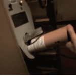
Today, Zawislak says there are two critical devices on the Lockheed Martin WP-3D he flies in for the National Oceanic and Atmospheric Administration (NOAA) that help inform our National Hurricane Center forcasts. First, there’s the plane’s on-board radar that measures wind and rain, and then there’s a little device that’s essentially a paper towel roll with a parachute on its back, called a dropsonde.
The dropsonde is a disposable instrument outfitted with a GPS receiver, as well as pressure, temperature and humidity sensors. The throw-away package gets stuffed out a window, and then sucked away from the plane. Over the course of a typical 8 hour flight, a dropsonde operator might plop 20 of them down into a storm, everywhere from the eye to the very outer rim, to examine how the windfield changes at different locations and heights in the storm.
As it falls to the surface of the ocean, each dropsonde radios its information back to the plane.
“It really allows us to profile the atmosphere, which is one of the most important things,” Zawislak said. “So we can see how the wind speed changes with height.”
All this information can dramatically shift how forecasters characterize a storm.
Take Zawislak’s Monday flight into Hurricane Florence, for instance. “It went from what looked like a category 2 hurricane, all the way to a category 4 hurricane, just because we had the aircraft,” he said.
Getting a job as a flying scientist
Zawislak, who holds a PhD in atmospheric science, has been working on both planes and unmanned drones that fly through hurricanes for roughly a decade.
As a Hurricane Field Program Director for NOAA, he is essentially in charge of a plane-sized research lab in the sky. He decides where the flight path will head to collect its best data, and makes sure the instruments on board are getting all the information they’ll need to answer key research questions in flight.
One of the biggest unanswered questions Zawislak still has about hurricanes is how they get so fierce, so fast. It’s still not well understood how storms organize and gather strength, developing from uneven messes of rain and light wind to powerful, swirling hurricanes that can rip through homes and pummel the shore with water.
It’s an important research question for Zawislak, because if he can better understand why and how the storms are intensifying, forcasts will improve.
Zawislak says he’s “not crazy,” he just wants to learn more about big storms
Zawislak tries to steer clear of greasy foods before he boards the plane, but he says that flying into a storm isn’t always a bumpy ride. In fact, inside the storm it can feel just like a commercial flight, with the seatbelt sign off and all.
The pilots Zawislak flies with (there are three of them in the cockpit) typically try to keep the plane level, for the sake of the instruments, and maintain a height of about 10,000 feet.
“We have the best pilots, the best engineers, the best mechanics, this is the best-maintained airplane you can find,” he said.
Still, the turbulence inside the plane can be unnerving at times, even with a harness on.
“You have flights where you’re in moderate to severe turbulence for two to three hours,” Zawislak said.
Inside the eye of a big storm like Florence, things clear up. At its very inner core, a hurricane is a place of peace, surrounded by violent chaos. Hurricane hunters say it looks like a big stadium, clear and serene.
“It’s much bigger than any stadium you’ve been in,” Zawislak said. When he flew through the eye of Florence, as a category 4 storm, the center was more than 15 miles wide, and took four minutes to fly through.
Despite the fact that Zawislak has to muscle his stomach through several long and bumpy rainy joy rides every hurricane season, he still wants you to know that he’s not completely out of his mind for taking this job.
“We’re not crazy” he said, before boarding another flight into tropical storm Isaac. “We are playing a humongous role in getting the information to the National Hurricane Center, so that they can tell the public how strong the storm is.”
IMAGES:
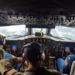
hurricane hunter jon.JPG
Zawislak at work. Jon Zawislak
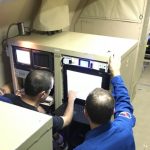
inside the hurricane hunter.JPG
Zawislak and a colleague examine the flight track and check data coming in from their instruments in flight. Jon Zawislak
Hurricane hunters are a critical component of hurricane forecasting, providing information we can’t get from satellites. Lt. Kevin Doremus/NOAA
For more on this story and video go to: https://www.businessinsider.com/what-its-like-to-fly-into-a-hurricane-according-to-a-scientist-2018-9?utm_source=feedburner&%3Butm_medium=referral&utm_medium=feed&utm_campaign=Feed%3A+businessinsider+%28Business+Insider%29


